CASSIOPE SPACECRAFT (Swarm-E)
PROCESSED DATA HANDBOOK
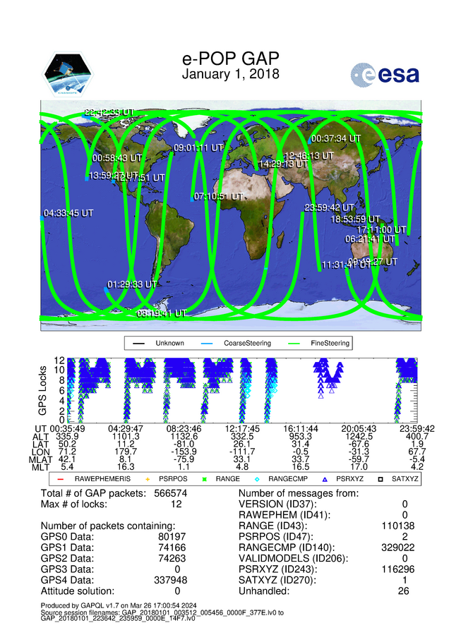
GAP Quick Look Plot
The GAP QL PNG file is a daily product. It contains a 2D geophysical map of CASSIOPE’s path over a 24 hour period for the times when a GAP-A receiver was running. The bottom plot shows the GPS Locks plotted against Universal Time and CASSIOPE’s ephemeris (geographic latitude (degrees), geographic longitude (degrees), altitude (km), magnetic latitude (degrees), and magnetic local time (hours)). Locks are plotted for a number of possible GPS messages, including raw ephemeris, pseudorange position (PSRPOS), range, range compressed (RANGECMP), pseudorange cartesian position and velocity (PSRXYZ), and GPS satellite positions in ECEF Cartesian coordinates (SATXYZ).